Georgia On My Mind
We arrived in Georgia on 2/28 and stopped by the Amicalola Falls State Park to register as a through hiker. Normally I'm not a joiner, but they do send updates on trail conditions if you register which could come in handy. They also gave me a tag for my pack with registration number 444.

Seemed like a good number, and my daughter pointed out to us that it had a special meaning in numerology.

Clearly we're off to an auspicious start. The ranger informed us that they expected 74 people to start tomorrow. Our plan is to get an early start expecting the trail and Springer Mountain to be a mob scene.
We made our way to our base camp at Whispering Pines Campground and got settled in. My old friend Steve Dean met us there and plans on joining me the first week of every month. He'll set out with me tomorrow on Springer Mountain. We've known each other since junior high school and managed to keep in touch through the years. It will be nice to have his company.
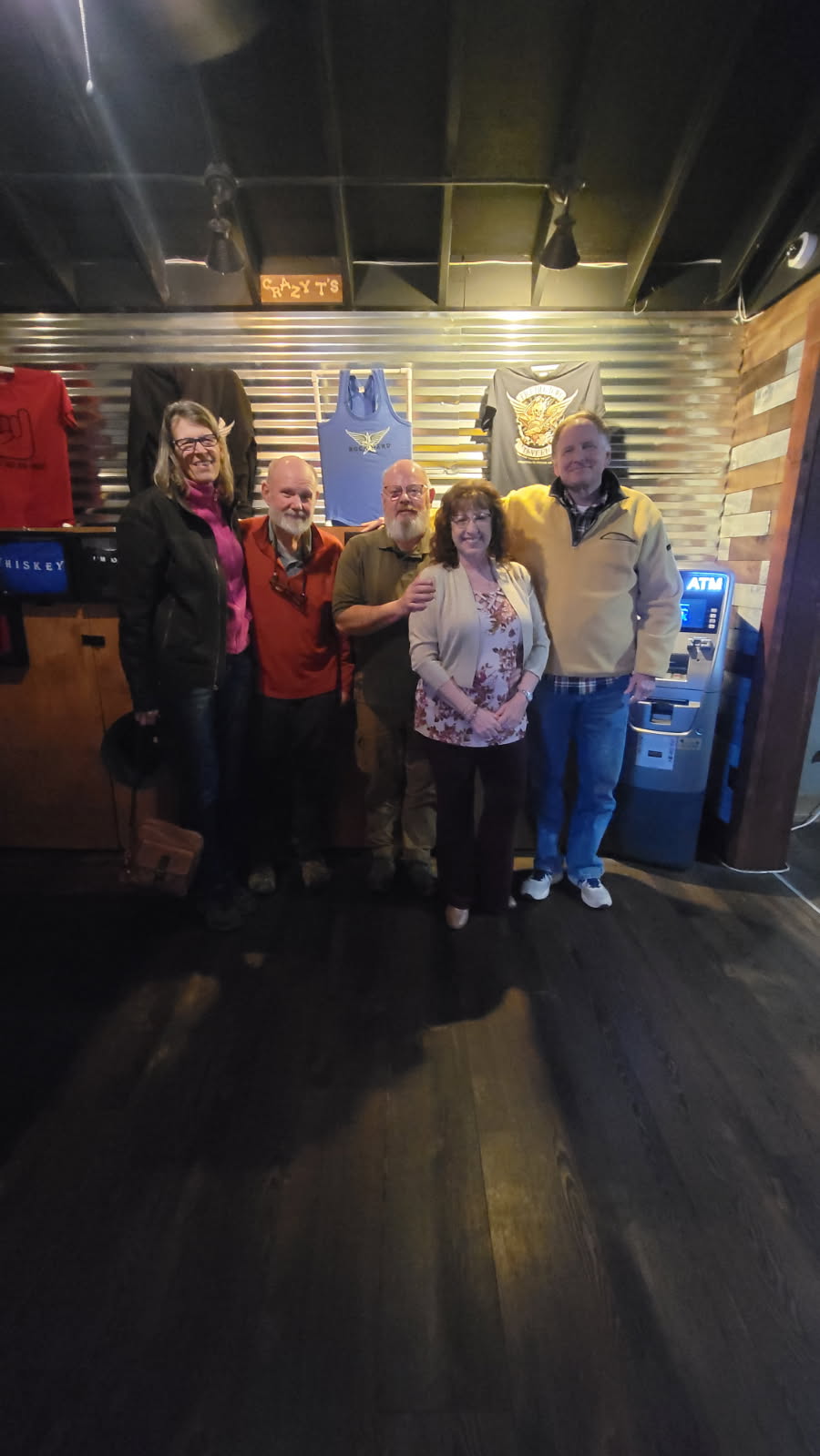
We met my brother Mike and his girlfriend Tracy at a restaurant the nice town little town of Blue Ridge close by our campground.
Got back and went right to sleep so we could get an early start in the morning.
3/1 Springer Mountain to Hightower Gap - 9.6 miles
For our first day out, we chose a modest section to get our feet wet.
We chose to climb Springer from Big Stamp Gap which was an easy one mile hike to the summit. There's a plaque at the top to mark the spot, so you can't miss it. Surprisingly, there was nobody else at the summit when we arrived! Where was the mob? They must have slept in.
On the way up we met a guy hiking down who asked us if we were lookie-loos. That was a new one on me...I'm going to learn a lot of new lingo on this trip I think. He meant were we climbing to gawk at the mob of through hikers coming through today. Just the opposite actually.

Then it was 8.6 miles on fairly easy terrain to our goal for the day at Hightower Gap. There was a bike race going on so we stopped for a bit to have lunch, watch the bike racers wizz by, and chat with the guy who was directing them to not make a wrong turn at the fork.
3/2 Hightower Gap to Woody Gap - 12.5 miles
Second day out and we pushed it a little further today. We're still feeling good and strong. The weather was chilly starting out, but developed into perfect conditions for hiking by midmorning.
The expected crowds still didn't materialize which was very encouraging. We might be just ahead of the bubble, which is the surge of folks starting the north bound hike this time of year.
The terrain is still quite gentle and the scenery is very pleasant with nice views down into the valleys and surrounding mountains.
We encountered a few folks on the trail and they inevitably ask where we're heading, and I answer "Maine". They comment on the size of my pack which is my summer day pack which just carries water and some warm clothes and a few other essentials. I then have to explain the strategy of Angelika meeting us daily. Now we learned the new term of the day, slack packing. This is the trail lingo for hiking without a full backpack relying on someone to meet you further down the trail with the rest of your gear. Of the folks we talked to, slack packing most of the way to Maine was "really smart".
Angelika started hiking southbound after shuttling the truck and met us around four miles in. Of course, we almost missed her because she was hanging out with a group that was offering trail magic to passing hikers at a road crossing. In this case, they were offering food, drinks, and trail essentials (did you forget to pack enough toilet paper?) to passing hikers.

After some chatting, we headed north to complete the last four miles. There were some nice overlooks along the way.

At the Woody Gap parking area, we stopped to partake of some more trail magic. A couple of hot dogs and a Kind Bar hit the spot at the end of the day's hike. We stayed and chatted with folks for a while and enjoyed the warm sun before heading back to the campground.

3/3 Woody Gap to Neels Gap - 10.6 miles
The temperature was 28 degrees when we got up this morning. It felt quite cold which didn't provide a lot of motivation to get out of a nice warm bed, but the trail beckoned. An older gentleman we met on the trail yesterday informed us that "the trail isn't going to walk itself" when we lingered too long to chat. This phrase is going to stick with us the rest of the trip.
I'm enjoying the way the trails are designed here and the beautiful vistas they have to offer along the way. I realized today it wouldn't be nearly as nice if the trees had their leaves. For now we can enjoy the views and the extra sun that gets through to provide a little warmth. Temperatures got to around 60 as the day progressed with nice blue skies to go with it. Pretty much ideal hiking weather.
Along the way today we noticed that large areas of the forest floor were torn up looking like an animal was rooting around for food. As we walked we wondered what might have done that: turkeys, deer, armadillos? We learned from a man at Mountain Crossings that it was likely feral hogs.
The highlight of the day was climbing Blood Mountain and visiting the stone shelter there. It was a long less gradual ascent than we've experienced so far. The views from the summit were great. A young guy from the area highlighted some of the points of interest you can see from there which included the highest point in Georgia, Brasstown Bald.
We took a break here for lunch. While we were eating a day hiker asked if I was on a quest, by which he meant were we through hiking. Not sure if that's official trail lingo, but I'll keep it in my noggin now so I don't seem so confused the next time someone asks me. He also claimed that the trail down was the steepest in Georgia. That may be true, but I know we'll have even steeper slopes to deal with in NH and ME before we're done.
3/4 Neels Gap to Hogpen Gap - 6.9 Miles
A short day today due to logistics with road crossings and shuttling vehicles. The weather is a bit warmer but heavily overcast with lots of rain forecast for the evening.
We started out the day moving our campsite to Desoto Recreation Area. Keeping our basecamp close by the road crossings is turning out more challanging than we expected. Many of the campgrounds in the area aren't opened yet limiting our choices. Finding places to boondock is a skill we're still developing. We'll hang out here for a while until something better turns up.
We picked up the trail at Hogpen Gap at the Mountain Crossings store. The tree in front of the store is covered wth old boots and shoes people threw up into the branches. We didn't get a straight story on how this came to be. I just assume its one of those things that one person started and others just followed suit. It makes for an interesting start to the hike in any case.

We started with a modest climb to the top of Levelland Mountain. We met a couple through hikers at the summit and chatted a bit. They're both novice hikers, so we heard about their mishaps, mistakes, and things they've learned over the past few days. One guy is carrying a huge SLR camera on his pack strap which is says he sacrificed a lot of other gear to bring along. He likes to take pictures of birds and was hoping to see some interesting wildlife along the way. He reminds me of my hiking buddy Tim who carried his big camera on some of our backpacking trips. He ultimately concluded that photo trips and backpacking trips really had different goals and fell back to carrying a small point and shoot camera on backpacking trips. It will be interesting to see how long the camera keeps its importance.
Moving along we met a young woman who passed us going at a good clip. Steve commented that he noticed she was wearing meager looking moccasin type shoes. A little further along I noticed she took off her shoes and was hiking barefoot. I have heard about barefoot hikers, but never actually encountered one until now. She slowed down considerably and we caught up with her a little further down the trail. Her feet were bothering her and she was letting them cool off, or at least that was the story she gave us.
Even though it was overcast, the views were still quite nice. We could see spots in the distance where the sun was managing to peek through. It made a nice contrast on the landscape between the sun and shadow. At times, the high points were socked in by low hanging clouds.

Around mile four we met up with Angelika hiking in from the other end. She brought good news that there was more trail magic happening at Hogpen Gap. We completed the last three miles with a short but steep climb up Wildcat Mountain and then down to Hogpen Gap where there was a church group cooking hamburgers and hotdogs, hot cider, and a nice gas firepit to warm up to. It was cooling off and there was a little drizzle as the clouds started rolling in. It felt good to get a bite to eat, sit by the fire for a little bit, and chat with the trail angels and other hikers.
A short day today, but we'll make up for it with a much longer day tomorrow.
3/5 Hogpen Gap to Unicoi Gap - 14.3 miles
Last night we had high winds and heavy rain overnight. When we got up in the morning, there was a large tree limb that the wind brought down in the ten feet between our van and Steve's truck. Our guardian angel was watching out for us last night.
Angelika set out with us for the first four miles this morning. Although we had a lot of miles to cover, the terrain was pretty easy. We managed to finish this section in a little over 6 hours including stopping for lunch at the Blue Mountain shelter.
We didn't run into anybody on the trail for the first three and a half hours, and then passed a handful of thru hikers after that. We met up with a Swedish hiker at the shelter that we've run into several times so far this trip. His trail name is Moose, but we just refer to him as the Swede. He's a nice guy and interesting to talk to.
The day was overcast and the temperature seemed to keep going up and down all day. The weather forecast called for it to clear in the afternoon, but it changed while we were hiking and there was a little bit of rain that came through instead. Luckily for us, we were already back in the car and safe from the elements.
On the way back to camp is a town named Helen. It's a recreation of a German village, so we couldn't resist visiting and walking around town a bit.


After dinner we went back to camp and got our backpacks ready for an overnight section tomorrow.
3/6-3/7 Unicoi Gap to Dick's Creek Gap - 16.7 miles
Another cold night and morning as we head out with full packs. We got snow overnight and there's about a half inch on the trail with some icy patches here and there. Our goal for today is to reach the Trey Mountain shelter only 5.7 miles from the trailhead. This is the first day hiking with full packs and the trail guide tells us this is the steepest section in Georgia, so we decide to plan conservatively.
The ascent starts immediately up Rocky Mountain and then down into Indian Grave Gap. It's cold and windy and the snow is making the footing a bit slippery, but we're making good progress.

As we approach Tray Gap what do we see here in the middle of nowhere but another group offering trail magic. This one is set up by the Boots Off Hostel in Tennessee with hot coffee, hamburgers, hot dogs, treats, and a roaring fire to warm up with. What a fantastic surprise and we take full advantage. It feels really good to warm up and get some hot food.


We get to the campsite at Addis Gap around 5:00 and decide to stop there while we still have some daylight. The campsite is a half mile off the trail downhill so it will be out of the wind which is still blowing. When we arrive its a nice flat campsite with a stream running through it and we're the only ones there. We set up camp, cook our dinner, and then get into the sleeping bags before it gets any colder.
It's a cold night and my feet are freezing, but the rest of me is comfortable in the sleeping bag. I don't really get a good night's sleep, so it's just as well we have a short day in the morning.
In the morning the temperature is still around freezing. We cook breakfast and pack up camp so we can get walking and get warm. We both slept late, so we're not on the trail until 9:00 or so. We do a long climb up Kelly Knob and then a lot of shorter up and downs as we make our way to Dick's Creek Gap.
Along the way we meet an AT Trail Ambassador who asks us how we're doing and we chat for a while. We're close to the North Carolina border now, but surprised to learn from him that 25% of the hikers who start drop out before leaving Georgia. So far the hiking has been pretty easy, but you do have to have a willingness to endure some discomfort along the way.
Angelika is waiting for us at Dick's Creek Gap which we reach before noon. We head back to our basecamp at Moccasin Creek State Park to resupply and get ready for the next day.
Steve is heading back home today having completed his week of hiking with me. It's been great having his company. We talked about family, friends, and what we've experienced over the last forty years. He's planning on joining me again the first week of April somewhere in northern North Carolina.


It’s been interesting to see the snow and cold on these first few days. What a great idea to document the trail this way! Had to smile at the description of the big SLR. I remember vividly slipping and smashing my lens on one of our hikes!
ReplyDelete